Surely if you’re an avid hiker you’ve looked for those trails that everyone seems to skip over and has overgrown just enough to feel like you’re really in a remote wilderness. Trails like those still exist, a few in the Great Smoky Mountains National Park. The Baskins Creek Trail falls under that classification if only for its cryptic location.
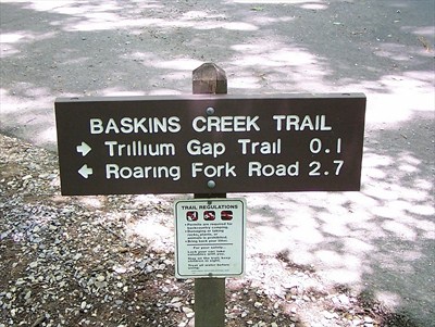
The lovely 2.7 mile trail begins at the junction of the Trillium Gap Trail and ends in the middle of the Roaring Fork Motor Nature Trail – a very popular route for tourists coming to Smokies for the first time. It’s a wonder that the trail isn’t more traversed due to the number of popular places in the area like Grotto and Rainbow Falls.
As mentioned, the Baskins Creek trailhead is located along the Roaring Fork Motor Nature Trail. Most hikers will park along Cherokee Orchard Road and walk along the trail before coming to the trailhead.
 Once on the trail trail, you’ll notice various red maples, oaks, Eastern hemlocks. In winter, you can catch glimpses of Mount LeConte along the trail. You’ll cross Falls Branch at exactly 1 mile into the hike by stepping stones before descending a short ways.
Hikers will be tempted at 1.4 miles to take the side trail leading to the base of Baskins Creek Falls. Be warned, this trail is not maintained by the national park or any other entity and is steep and can be extremely slippery for even the best of outdoorsmen.
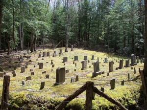
You’ll cross Baskins Creek again at mile 1.6 after walking through a rhododendron tunnel then start a climb up a gulch where you can hear the Roaring Fork on certain days. The trail ends at the Bales Cemetery and the junction of the Roaring Fork Motor Nature Trail.
