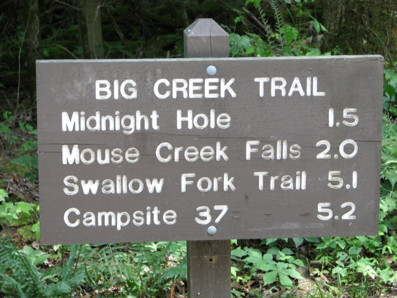
The Big Creek Trail is a fairly moderate and a good hike for beginners and new hikers. You could actually say the trail moves at a steady incline once you begin at the trailhead – located at the Big Creek Picnic Area.
The trail is rather easy to reach from Interstate 40 in Tennessee traveling east. Exit 451 is the specific marker you’ll be looking for. Take a left following the exit and proceed 2.3 mile after crossing the Pigeon River. You’ll pass the Big Creek Ranger Station before reaching the trailhead at 3.4 miles.
As previously mentioned, the Big Creek Trail is a great hike not only due to the encouraging landscape, but for the number of water features you pass along the trail. It’s an area rich with history as numerous Indian tribes and various people used the trail to travel from Tennessee to North Carolina and back.
After arriving at the trailhead, you’ll have noticed the parking area and ranger station. The Big Creek Trail officially begins just uphill from the parking area. On its way to Walnut Bottom, the Big Creek Trail ascends steadily throughout making its way along the creek. One mile into the trail, a vague trail breaks off to the Rock House, which is visible from the trail. This shelter of rocks was once used by loggers working the area at the turn of the last century.
At 1.4 miles you reach one of the big draws to Big Creek Trail – the Midnight Hole. This large, deep, green pool attracts people from everywhere wanting to enjoy the beauty of the Smokies and cool off at the same time. Mouse Creek Falls comes up at the 2 mile mark – another great site for the photography lover in everyone.
Brakeshoe Spring is crossed at mile 2.8 and hikers will notice to mossy grey stone and the tiny spouts dipping under, through and beside the rocks.
At 5.1 miles into the trail, a sign for the Swallow Fork Trail, which climbs 4 miles to Pretty Hollow Gap on the Mount Sterling Ridge Trail, comes into view. Backcountry campsite No. 37 – Lower Walnut Bottom, is reached at 5.3 miles. Hikers come to the end of the Big Creek Trail at 5.8 miles which is the location of the Upper Walnut Bottom Campsite (No. 36 and reserved solely for horse parties) and the junction with the Camel Gap Trail.
