Cataloochee Divide Trail

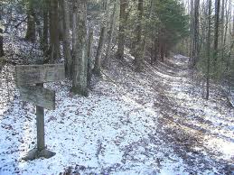
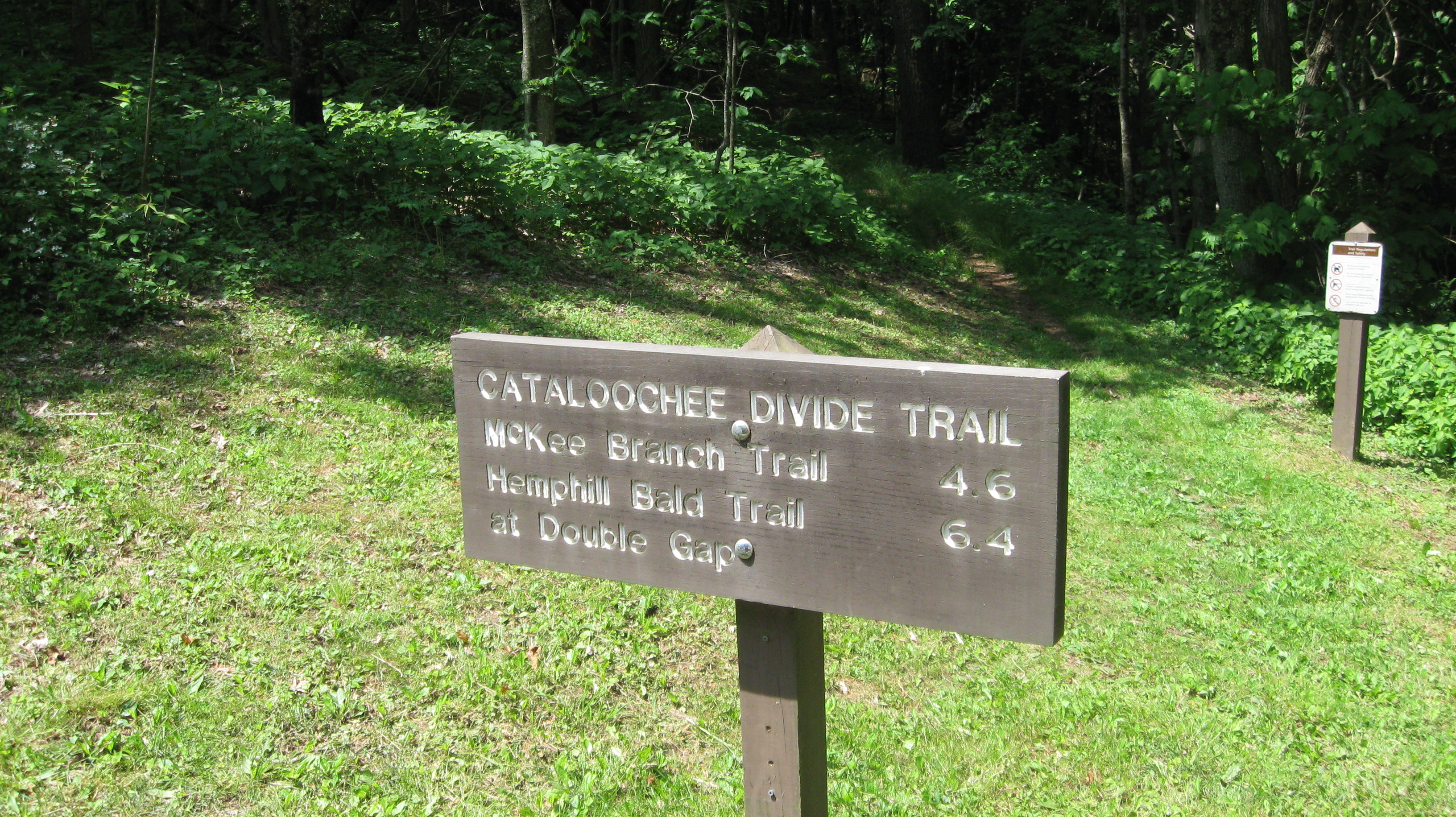
The 6.4 mile Cataloochee Divide Trail is excellent hiking trail for seeing some of the majestic views and vistas offered in Great Smoky Mountains.

To get there, travel Interstate 40 to North Carolina 276, exit 20, and drive west to Cove Creek Road. From there, you’ll turn north and travel 3 miles to the Cove Creek Gap where you find the trailhead.

Climb through the white pine grove as you begin on the trail, pass a rock outcropping, and walk along the fence line. You’re well on your way on the Cataloochee Divide Trail. It levels out at 1.2 miles in. You’ll notice a green cove to the right – the perfect spot for a bear sighting. If you look through the trees further down the trail on the right, you might even get a glimpse of the Cataloochee Valley.

Hikers will come to another clearing on the left. From there, hikers will be able to make out Interstate 40 and Cove Creek Valley. When you reach 1.9 miles on the trail more climbing begins through oaks and maples and hickories before heading downward again and leveling off

Hiking Trails

Juney Whank FallsHiking is probably the most popular activity in the Smokies.  There are hikes for every level of hiker.  Strenuous to easy, leisurely walks in the woods to all day and overnight hikes that require permits to stay in the backcountry the Great Smoky Mountains National Park has everything a hiker could want in a trail.

Make sure, if you are going to spend a lot of time hiking in the Smokies that you pick up their little brown book.  Titled “Hiking Trails of the Smokies” this book has every trail in the Smokies and gives pertinent information like, elevation, length, highlights and even landmarks so that you track your progress along the trail.

Abrams Falls Trail – This is the trail that starts at the Abrams Creek Trailhead in Cades Cove and runs to Abrams Falls.  This is a highly trafficked trail and one that is wide enough through the majority of its length to walk two or three abreast.  Rolling hills add a touch of difficulty but the payoff of the beautiful Abrams Falls and the swimming hole around it is spectacular.

Kephart Prong Trail – Named after one of the people that helped the Smokies become a national park, Horace Kephart, the Kephart Trail is 2 miles into the mountains from the North Carolina side of the park.  At the end of the Kephart Prong Trail, you come to the Kephart Shelter, which you can reserve for backcountry camping before you make your choice of the other trails to branch off from after a night spent in the shelter.

Gatlinburg Trail – This trail connects Gatlinburg and the Sugarlands Visitors Center.  A well maintained, easy trail with no steep grade or elevation change, the Gatlinburg Trail is an quick 2.5 mile hike through lush forest along the side of a bubbling mountain river.  Within the first mile and a half from Gatlinburg, you cross a foot bridge and then began a slow assent past a former CCC camp.

Laurel Falls – This is the most popular trail in the Smokies.  Easy is the best word to describe this trail.  Paved, wide and short, you can hike this trail in an afternoon.  At Laurel Falls you get to experience the fun of hiking in the Smokies while not having to get off road and hike on a dirt trail.  And the payoff is a beautiful view of Laurel Falls – one of the most photographed waterfalls in the Smoky Mountains.

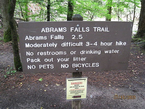
Abrams Falls Trail

  • 4.2 miles in length – 2.5 miles to Abrams Falls
  • Starting Points – Abrams Falls Trailhead parking area (halfway around the Cades Cove Loop Rd)
  • Points of Interest – Abrams Creek & Abrams Falls
  • Difficulty – 1

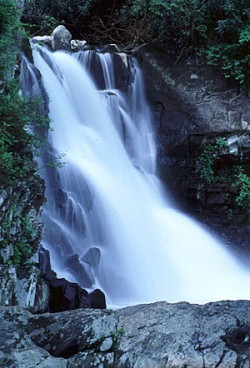
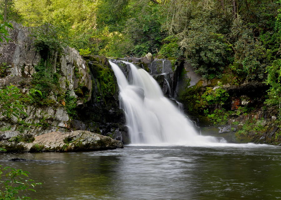
Abrams FallsWhen you are driving around Cades Cove you are going to notice a pull off the main road about halfway around, right past a bridge.  You will see a sign for Abrams Falls.  Pull into the parking area, get your hiking gear out of the car and prepare for a journey.  This is an easy hike on a well maintained trail.  The pay off, about halfway down the trail is Abrams Falls – a gorgeous waterfall and a great place to take a dip in a mountain stream.

The trail itself is great.  From the start until almost the revelation of Abrams Falls this trail is wide enough to walk side by side with your hiking buddy.  The 2.5 miles to the falls is gently rolling with no huge increases or decreases in elevation.  Remember this is not a loop trail so you are going to have to hike back out from the falls as well.  The remaining 1.7 miles to the junction with Hannah Mountain Trail and Hatcher Mountain Trail is downfall and the trail is considerably more narrow.

The trail follows Abrams Creek from the trailhead where it is a wide creek to the falls were it plunges down the mountain.  The creek, at the trailhead, provides great opportunities to wade and frolic in the water.   The kids can get some of that restless energy from riding aroud the cove out as the splash each other and everybody else around them.  Further along the trail the creek offers some great chances to chase the elusive trout.  Abrams has some great fishing.  The first mile of the trail stays right next to the water and you can easily walk to the creek and cast while you hope to land that trophy trout in the Smokies.

The falls, though, is the highlight of the trail and the payoff for the hike.  The falls drops 20 feet into a huge round swimming hole.  Crystal clear, unless it has rained a lot recently, the water is cool even during the summer but after a brisk hike into the mountains it feels great whether you choose just to dip your feet in the water or go swimming.  The falls are one of those iconic images in the Smokies, being photographed thousands of times a year.  Remember though, even though the water is clear it is not safe to dive into the water at Abrams falls, serious injuries have occurred when people dove into Abrams Creek at the falls.

Curry Mountain Trail

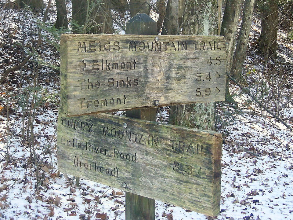
Curry Mountain Trail1A great little history hike in the Smokies can be had on the Curry Mountain Trail, a 3.3 mile jaunt from Little River Road to the junction with the Meigs Mountain Trail.

To reach the trail, travel to the Metcalf Bottoms picnic area on the Tennessee side of the Smokies near Gatlinburg and along Little River Road. Wlaking 100 yards eastbound, you’ll come to the trailhead, as well as an orange gate on you right.

You’ll traverse two 3,000-foot peaks on this hike – Curry He and Curry She. Hikers will climb along the side of Curry He, cross a gap, then climb by Curry She to reach the intersection with the Meigs Mountain Trail. You’ll also come to a small cemetery that once served the community that lived in the vicinity of the trail.

Curry Mountain Trail2As you set out on the trail, notice the various hemlocks and other hardwoods as you parallel Little River Road to begin. The trail turns from grassy to rocky before you come upon a switchback that leads the hiker into a more open forest with wildflowers that bloom in abundance during the spring months.

The next marker on this trail are the stone walls that align the next part of the trail. You can see where these might indicate old homesteads.

Curry Gap is crossed at 1.9 miles on the trail. You’ll continue to climb for 0.3 miles more before leveling out on Long Arm Ridge.

As you near the end, the trails widens and you reach the end with the junction of the Meigs Mountain Trail. You can hike on to the right to reach the aforementioned cemetery. Go left and you’ll eventually reach Elkmont.

Boogerman Trail

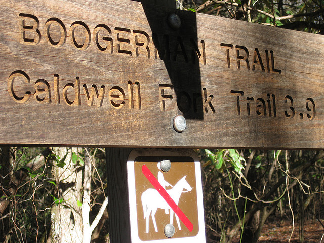
The Boogerman Trail in the Great Smoky Mountains has it all – old growth forest, picturesque streams and waterfalls, and what’s left of a few early Smoky Mountain homesteads. Now that you know that, a challenging 7.4 mile round-trip doesn’t seem all that bad.

You’ll find the trailhead in the Cataloochee section of the park, which is located on the North Carolina side of the Great Smoky Mountains National Park and can be a little more difficult to reach, but well worth the effort. From Interstate 40, NC State Route 276, and Cove Creek Road, navigate your way to the Caldwell Fork Trail (follow the signs).

During the Boogerman Trail hike, you’ll gain approximately 800 feet and reach an altitude of 3,600 feet. The trail gets its name from Robert “Boogerman” Palmer, whose old homestead in seen along the trail, as well as some of the region’s largest trees and various mountain streams. The Boogerman Trail also passes through some pristine wilderness that was untouched by logging companies who made their way through the Smokies before the land was purchased by the federal government and subsequently designated for use by the national park.

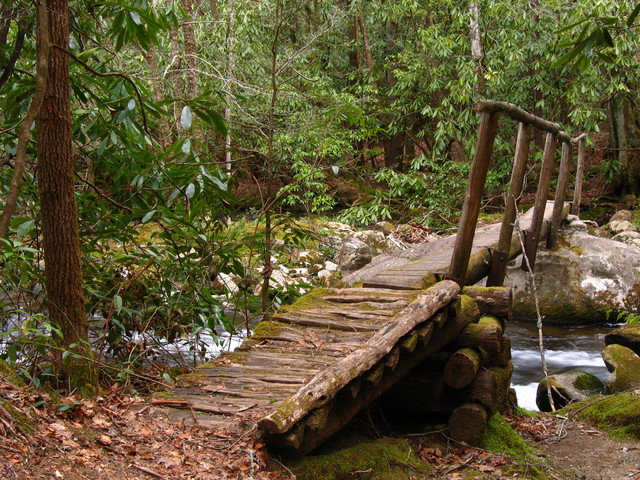
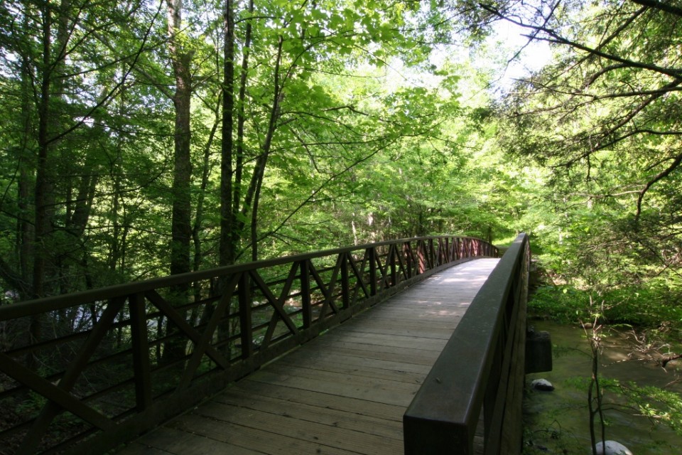
Upon arrival at the Caldwell Fork Trail, cross Cataloochee Creek by footbridge before coming across a slew of white pines. You’ll stay right when the trail splits before crossing Caldwell Fork on a footbridge.

At mile 2.8, you will encounter the Palmer homestead.

The trail turns to follow Snake Branch at 3.8 miles into the loop, before turning again around a rock wall, and traversing a small stream. Old fence posts and piles of stone now dot the landscape, indicating an area of early homesteads which once stood by the creek.

Snake Branch is crossed at nearly 5 miles into the hike. Towering hemlocks are also seen before the path takes you across Caldwell Fork a hand full of times via log footbridges. Several hundred yards before crossing Cataloochee Creek at approximately mile 7.4–and completion of the loop–you will see the remains of a cabin and barn built by Carson Messer.

The Boogerman Trail hike is a wonderful way to get to know the Cataloochee area of the national park, and I came away feeling stronger and more fulfilled than when I arrived.
 

Jonas Creek Trail

The 4.1 mile Jonas Creek Trail in the Great Smoky Mountains is an uphill hike complete with scenic views and sporadic cascades as it makes its way from the junction of the Forney Creek Trail at backcountry campsite No. 70  to the trail’s meeting with the Welch Ridge Trail.

To reach the Jonas Creek Trail, you’ll have to really be wanting to hike this section of the national park. First, hikers must travel the Forney Creek Trail to the starting point – 3.7 miles north of its junction with the Lakeshore Trail.

Hikers begin by crossing a foot log over Forney Creek and passing through backcountry campsite No. 70 – a horse camp as well. You’ll go on to cross Jonas Creek once you reach 0.4 mile on the trail. The rocks are slick and mossy so take care as you cross the stream. The trail becomes rocky on the other side and you’ll pass a majestic waterfall just to the right of the trail.

After crossing Jonas Creek a second time, you must skirt or walk through creek runoff as it flows over the trail. At this point it’s a very wet walk along the trail. You’ll cross Jonas Creek a third time but there is a rock hop to help you across.

You’ll hike across Jonas Creek a couple more times before you reach the junction with Little Jonas Creek 1.3 on the trail. You’re on the way to Welch Ridge. Some of the various trees you pass along the way include sassafras, sourwood, oak, and American beech. Yanu Branch follows the trail and you’ll eventually have to cross it by way of a foot log.

The next part of the Jonas Creek Trail is especially eye-catching so be sure you’ve packed a camera. The 100-foot cascade that comes up on the right of the trail is very notable. This is followed by a series of switchbacks that make up the trail before you start your climb up Yanu Ridge. You reach the top at the 3.4 mile marker. The finale of the Jonas Creek Trail is reached at the junction with the Welch Ridge Trail. Enjoy the Smokies!

Hannah Mountain Trail

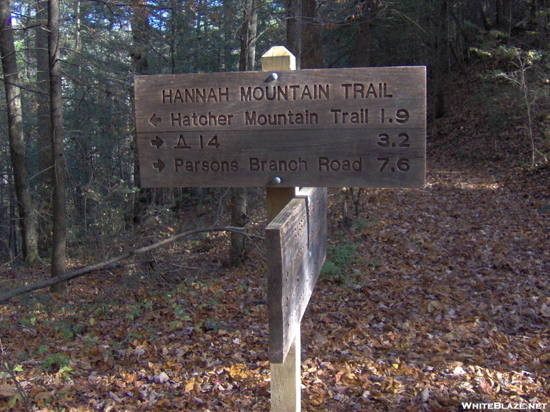
If you’re looking a pretty good 9-miler in the Smokies, look no further than the Hannah Mountain Trail which stretches from Parson Branch Road to the junction of the Hatcher Mountain and Abrams Falls trails at Abrams Creek.

This is a great trail for taking in some spectacular Smoky Mountain views as you’ll be doing a fair share of ridge hiking as you make your way along the 9.5 mile trail.

To get to the trailhead at Sams Gap, make your way to Cades Cove in Townsend, Tn and start out on the Cades Cove Loop Road. From there, you’ll turn off Loop Road just past the Cable Mill historic structure and follow the signs to Parsons Branch Road. The trailhead at Sams Gap is 4 miles from the start of Parsons Branch Road.

This easy walking trail begins its ascent up the ridge and through a beautiful wooded area before you reach a large tulip tree – the first significant natural marker found along the trail, 1.9 miles in.

Mount Lanier is reached by way of the Hannah Mountain Trail. It’s also the highest peak on the trail. Hikers descend Lanier toward Bell Cove in to a mixed hardwood forest of hickory, maple, and hemlock among other species.

Hiking around the north end of Hannah Mountain, you soon find yourself coming upon Flint Gap and backcountry campsite No. 14. Flint Gap gets its name from the blue flint that was once found in this section of the national park.

Continuing on the trail, you’ll find that it tends to curve back before passing what remains of a large chestnut tree. At one time there was a cabin that sat in the area just past the fallen chestnut which was home to several pioneer families.

The next portion of the Hannah Mountain Trail starts out at a climb. This is known as Polecat Ridge and it goes on to descend to Scott Gap 7.6 miles along the trail. Backcountry campsite No. 16 is located around 100 yards below Scott Gap. A quick suggestion, if you’re planning on camping at this campsite get there early, especially on weekends. It’s a rather popular spot in the park.

The rest of the Hannah Mountain hike will be a fairly steep ascent to the Abrams Creek junction. You’ll have to ford the creek yourself to get across. Hope you enjoyed the Hannah Mountain Trail!

Hatcher Mountain Trail

So you’ve decided to make it a day trip to the Smoky Mountains and you’re looking for an easy day hike that will let you take in some of the national park’s beautiful hardwood forests but won’t leave you gasping for air at the end. Well, if you’re asking us, we’d tell you to seek out the Hatcher Mountain Trail.

The Hatcher Mountain Trail is a 2.8 mile hike from the Cooper Road Trail to the junction of the Hannah Mountain and Abrams Falls trails. To get there, park at the rangers station at the Abrams Creek Campground in the Smokies. From there it’s a 4.9 mile hike to the trailhead along the Cooper Road Trail.

Starting out on the trail, you’ll slowly ascend the southern slope of Hatcher Mountain through a picturesque hardwood forest. Oaks and pines can be found along the path as you pass over the ridge and descend to Oak Flats Branch. However, flat is a relative term for this area of the Hatcher Mountain Trail.

Soon enough though you’ll find yourself making your way along a wooded hike again. Beautiful, yet small wildflowers can be found in abundance in this area as you hike to the junction of Little Bottoms and the Abrams Falls trails. Enjoy the rest of your day in the Smokies!

Huskey Gap Trail

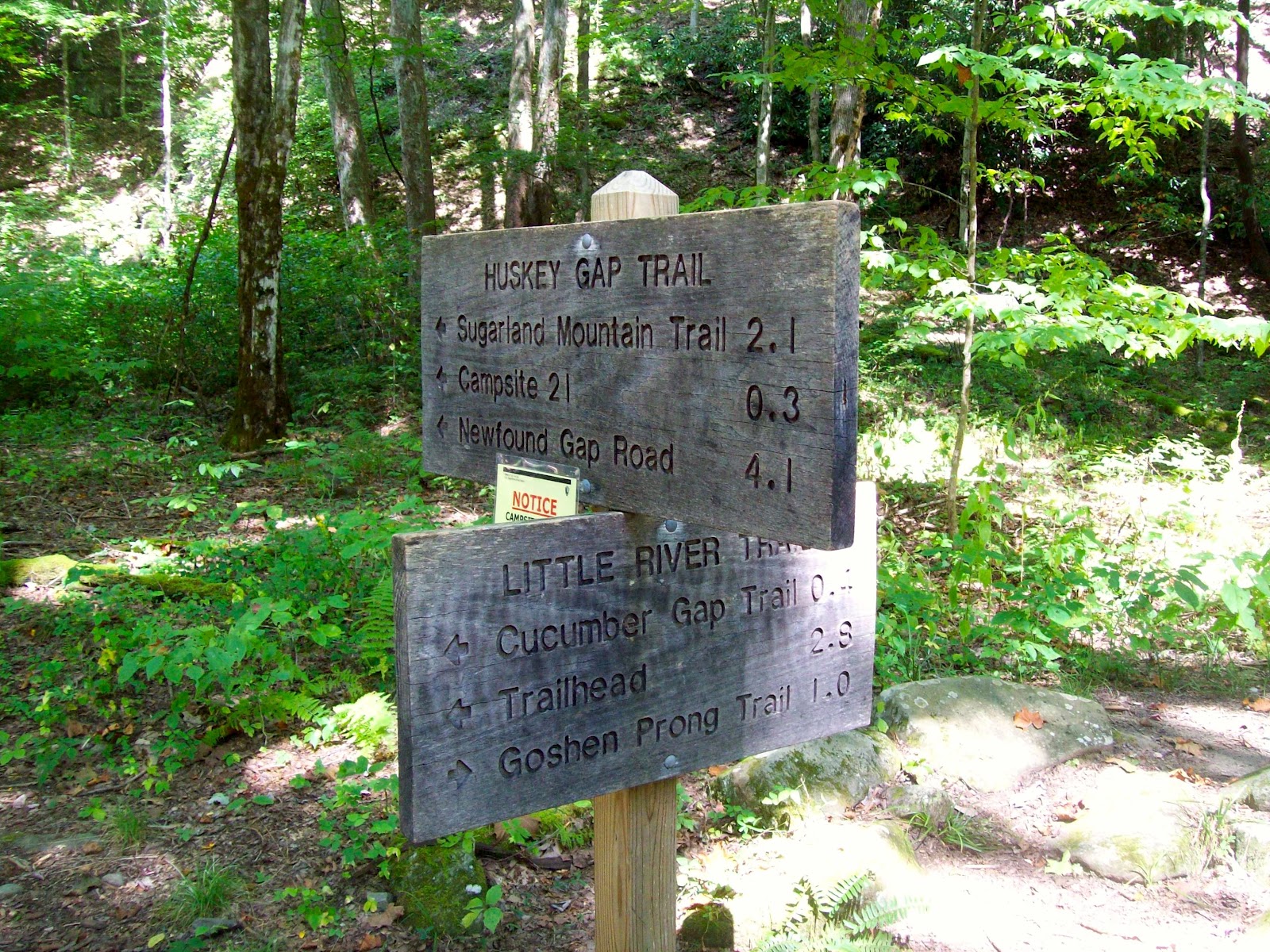
Another Gatlinburg trail, that is in relative close proximity to the popular Smoky Mountain vacation town, the Huskey Gap Trail is a moderate 4.1 miles from Newfound Gap Road to the Little River Trail.

It’s a great trail if you’re just looking to get out in the woods for a bit, but you want to stay close to town.

Reaching the trailhead, all it takes a trip down Newfound Gap Road for 1.5 miles. You’ll be traveling southward from the Sugarlands Visitor Center and can park at the second quiet walkway that you come to on the left. The trailhead is across the road.

As you start out, notice the rock wall that follows the trail on the right and just below the path. As you’ve probably already guessed, this was once a Smoky Mountain homesite linking these dwellings to the Sugarlands community. This a wonderful trail to hike in the spring time as wildflowers align both sides of the path before you begin the upward hike.

Flint Rock Branch can be heard as you move along the trail, which you must pass over soon. Once you’ve reached that point, you can catch some great shots of Mount Harrison, English Mountain, and Mount LeConte to your right.

Approaching Huskey Gap, you can look off the trail and spot Gatlinburg and all the cabins and chalets that surround the popular Smoky Mountain town. Old Huskey Gap Road lies right below the gap on the right as you move on. Around the turn of the previous century, the Huskey Gap school even operated in this area educating children who lived in the Sugarland Branch community.

The Huskey Gap trail was a popular route for early Smokies settlers who worked in the Little River Lumber Camps. Soon you’ll pass the trail’s junction with the Sugarland Mountain Trail. You’ll soon cross Big Medicine Branch, then the trail will level off and make a more gradual decent to Little River where you’ll cross over a dry stream bed.

Backcountry campsite No. 21 comes up on the left moving along. Reservations are required to camp at this backcountry site. A few more steps and you’ve reached the junction with the Little River Trail and the completion of the Husky Gap Trail. Let us know your experiences on the Huskey Gap Trail in the comment section below. We’d love to hear them!

Lakeview Drive

The Road to Nowhere

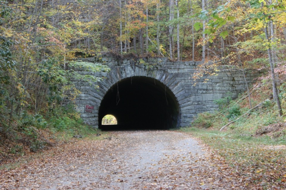
This six-mile drive is also known as “the Road to Nowhere” and affords great views of Fontana Lake.   Lakeview Drive ends one mile beyond a viaduct at the mouth of a tunnel. Work on the road stopped in 1943 and was never continued. “The Road to Nowhere” actually takes you to some nice hiking trails. Lakeshore and Tunnel Trails begin at the end of the parking area. The Lakeshore Trail is one of the newer trails in the Park, extending along the south boundary for about 44 miles. It is actually a configuration of trails developed from old manways, older existing trails, and roads.

This road was constructed shortly after Fontana Dam was constructed and Lake Fontana was formed.  With the flooding of the towns of Judson and Proctor, the Great Smoky Mountains National Park needed a way for people visiting the park to get to the park side of Fontana Lake.  The people that had been displaced from Judson and Proctor also needed a way to reach the cemeteries that were located inside the boundaries of the National Park.

They were promised a road that would extend into the park and all the way to these areas that were cut off.  The construction of Lakeview Drive began in 1943 and though progress was slow it continued until 1972 when funding ran out and the construction halted.  The matter of whether this road would be finished was batted around on a local, state and federal level until 2010 when it was decided that a payout would be made to Swain County, North Carolina instead of the road being completed. Now, to reach the areas of the flooded cities that are inside the GSMNP, they either have to hike overland or wait until the one time a year when the park service takes people across the lake for a homecoming time at the cemeteries.

For this reason, Lakeview Drive is known as the Road to Nowhere.  You can drive this secluded road into the park and take in the beautiful views of Fontana Lake.  Also, if you are into bicycling, this area is not as traveled as most and it gives you a chance to bike without having to worry about a lot of cars.  The road ends at the start of several trails and at the last tunnel that was constructed.  The tunnel was finished and is even paved.  You actually walk through the tunnel to get to the trails.

To get there, travel south on the Newfound Gap Road into Cherokee NC. In Cherokee, turn right on US 19 and drive 10 miles to Bryson City. At the old Swain County Courthouse, turn right onto Everett Street and cross the Tuckasegee River. Follow Everett Street through town (it changes to Lakeview Drive) and continue to the Park boundary. Continue 5 miles into the Park.